Environmental Monitoring & Conservation
One shared map for environmental monitoring and conservation
Track survey sites, inspections and field activity across landscapes in one structured workspace organised by location.


BEST OF 2013
Rated 4.7/5


FEATURED APP

See every site in context
When monitoring spans regions, visibility fragments. A shared map keeps each site structured and accessible.

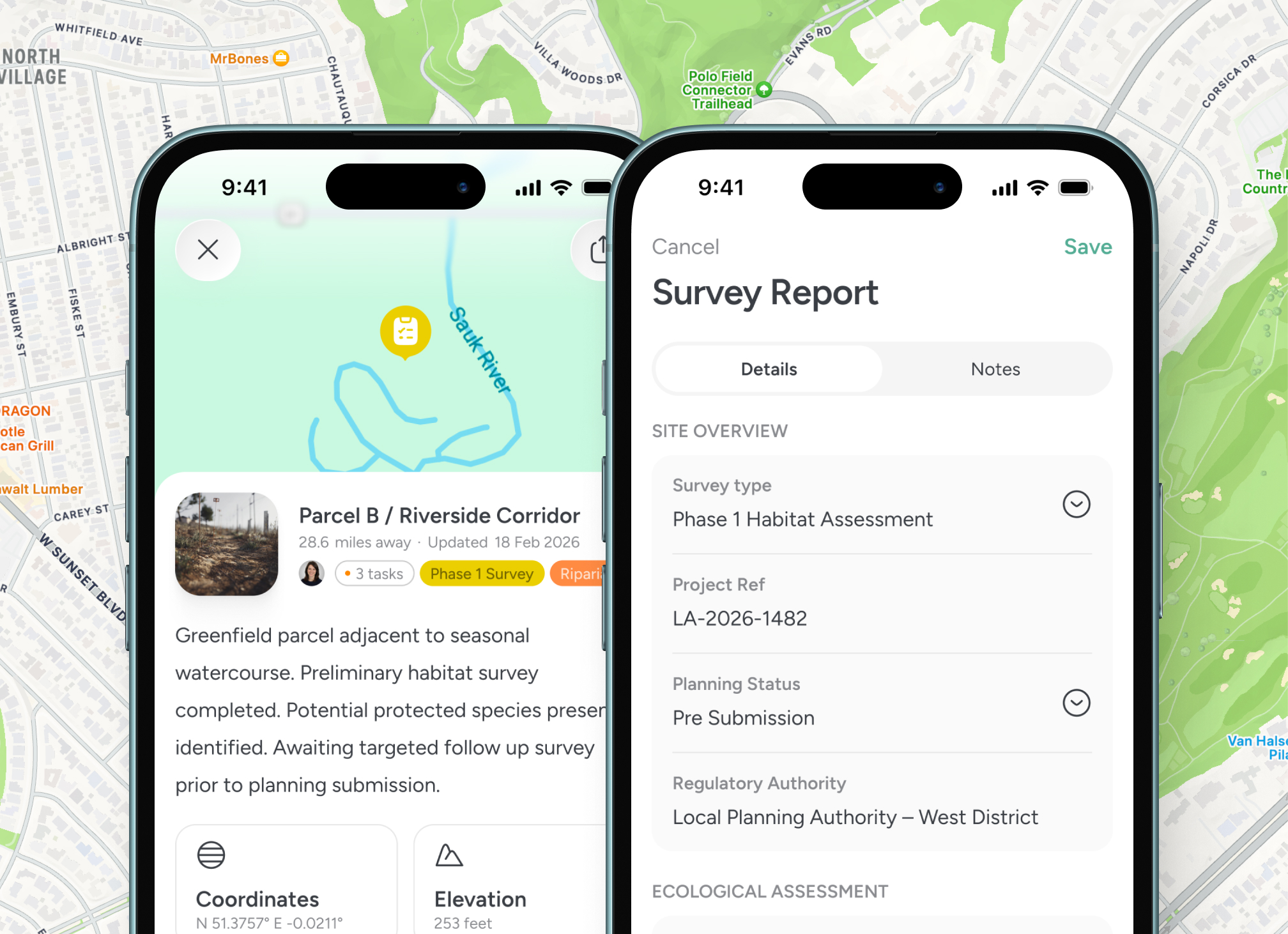
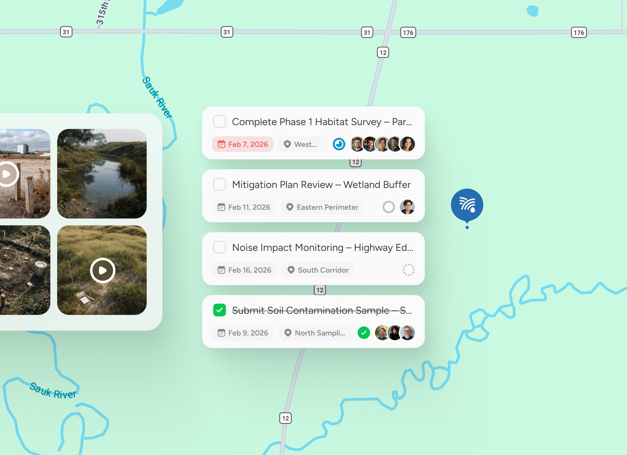
Log observations where they occur
Notes, photos and survey data remain tied directly to the exact location.

Coordinate field teams efficiently
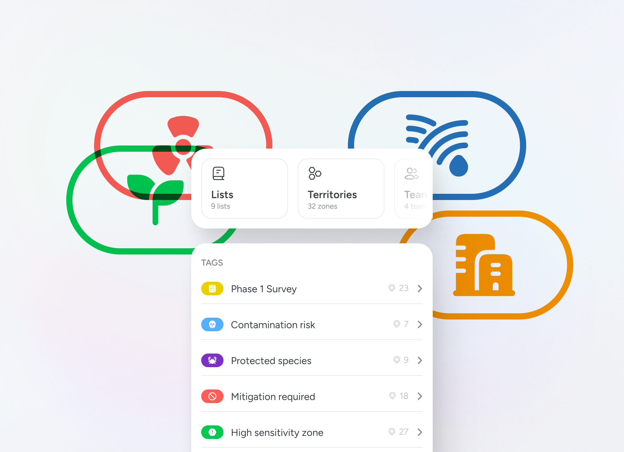
Assign responsibilities by site to reduce duplication and missed coverage.

Maintain defensible records
Keep structured, location-based history for reporting and compliance.
Structured field monitoring
Organise survey sites and conservation activity by location

Location-based environmental oversight
Every site, inspection and update is anchored to place, giving environmental and conservation teams a live operational view across landscapes.

Testimonials
Used by teams managing environmental sites
Environmental and conservation leaders rely on structured, location-based visibility to coordinate monitoring activity and maintain defensible records.


“Notes, locations and progress stay together, which makes reporting much more reliable later on.”

Priya
Environmental Survey Lead
“Having a clear, location-based record has strengthened our oversight across multiple conservation sites.”
Maya Shaw
Habitat Monitoring Coordinator
“We can see which areas have been covered and plan the next round of surveys without guesswork.”
Jonas Krul
Environmental Field Lead
Guided walkthrough
See environmental monitoring on a shared map
Explore how structured, location-based coordination can improve visibility and accountability across your monitoring programmes.


